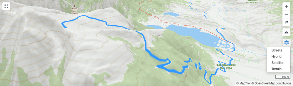
What additional features can I use on the maps?
The maps show your race course along with indicators for the start, finish and the athlete. As you mouse of the Power Plan Chart, Time Analysis Chart or Weather Chart you will see the athlete indicator move along the course showing your location as it relates to charts.
Additional Features
Click the plus icon to zoom in to an area of the map. You can also double click on the map itself to zoom.
Click the minus icon to zoom out for an overview of the surrounding area.
Click click the compass icon to reset the map's bearing so that north is up. This button can also be used to change the pitch/angle that the map is viewed at, which is helpful when viewing terrain with 3D elevation.
You can rotate the map and adjust the pitch/angle by holding the control key (Mac) or command key (PC) and clicking on the map then dragging. On iPhone this can be done by using 2 fingers on the map and dragging.Click the mountain icon to display the map with 3D terrain. 3D terrain is best viewed along with a pitch/angle.
Click the layers icon to select alternative map styles such as Street, Hybrid, Satellite or Terrain.
Click the expand icon to view the map full screen. To exit full screen press the "esc" key or click the full screen button again.